India’s Controversial Political Map: Ignoring UN Resolutions and Regional Stability
June 14, 2024India has directed all private satellite television channels to exclusively use the latest political map of India, which incorporates the disputed territories of Jammu and Kashmir, including Ladakh. This directive comes from India’s Ministry of Information and Broadcasting, aiming to standardize the depiction of these regions in media broadcasts.
This decision by India contradicts the resolutions of the UN Security Council, which recognize Jammu and Kashmir, including Ladakh, as a disputed territory. The UN has consistently emphasized the necessity for a peaceful resolution through a plebiscite, acknowledging the unresolved status of the region.
By enforcing the use of this new political map, India is effectively altering the status of these disputed territories without international consensus. This unilateral action has the potential to escalate tensions in an already volatile region, where territorial disputes have historical and geopolitical implications.
UN Security Council resolutions such as Resolution 39 (1948), Resolution 47 (1948), and Resolution 307 (1971) reaffirm the disputed status of Jammu and Kashmir under international law. These resolutions underscore the importance of respecting the aspirations of the local population and seeking a peaceful resolution through dialogue and diplomacy.
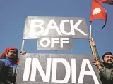
The issuance of this advisory raises concerns about its impact on regional stability. The disputed status of Jammu and Kashmir has been a longstanding issue, with India and Pakistan both claiming sovereignty over different parts of the region. The unilateral move to alter its depiction in maps could heighten tensions and complicate efforts towards peace and stability.
Internationally, India’s decision may face scrutiny for its compliance with international law and adherence to UN Security Council resolutions. The move challenges the established framework for resolving the Kashmir conflict and could influence perceptions and policies among other nations involved in regional diplomacy.
The directive also highlights the role of media in shaping public perception and understanding of geopolitical disputes. By mandating the use of a specific political map, India aims to influence how these territories are viewed domestically and internationally, potentially shaping public opinion on a contentious issue.
India’s advisory on the use of political maps containing disputed territories reflects its unilateral approach to the complex issue of Jammu and Kashmir. This decision, while aimed at asserting sovereignty, risks exacerbating regional tensions and complicating efforts towards a peaceful resolution under international law and UN frameworks. The implications extend beyond mere cartographic representation, impacting regional stability and diplomatic relations with implications far beyond national borders.